|
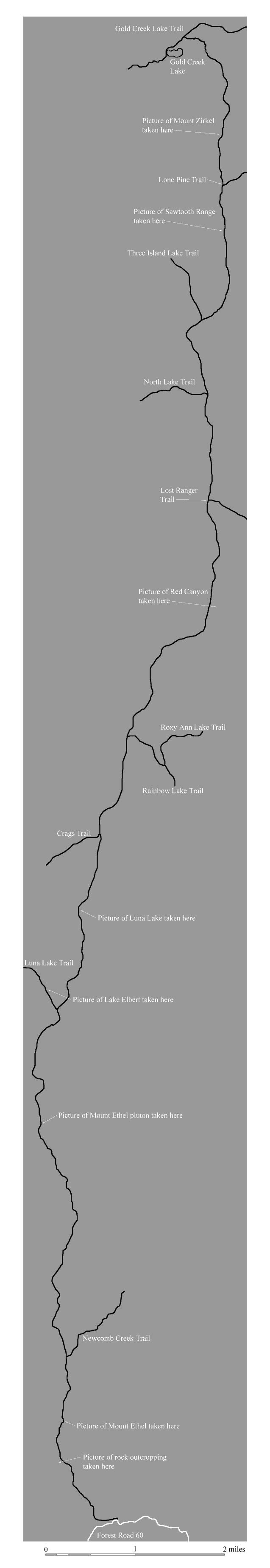
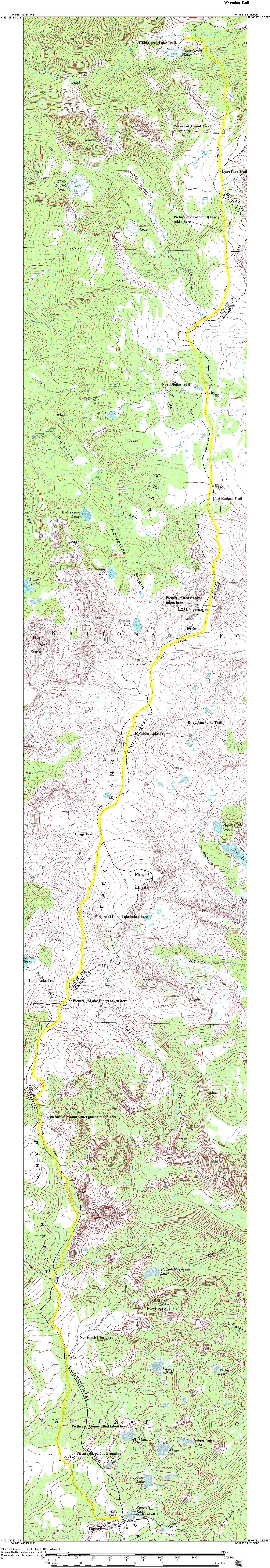
The map above is provided to minimize download time. To see the full topographical version of the map, click on the thumbnail below. Be aware that the file is about 1.8 megabytes and will take a long time to load on a dialup modem.
Click on the thumbnails below to view full size photographs.
|
|
|
|
|
|
 |
|
|
Outcrop along trail
|
|
This outcrop not far from the Buffalo Pass Trailhead shows glacial sculpting along the top of the mountain range here, indicating this area was covered by an ice cap during the last glacial period.
|
|
|
|
|
|
|
|
 |
|
|
Mount Ethel Pluton
|
|
This picture shows the terrain typical of the Mount Ethel Pluton when facing north.
|
|
|
|
|
|
|
|
|
|
 |
|
|
Lake Elbert
|
|
This shows Lake Elbert, found near Wyoming Trail.
|
|
|
|
|
|
|
 |
|
|
Luna Lake
|
|
This is how Luna Lake looks from Wyoming Trail
|
|
|
|
|
|
|
 |
|
|
Red Canyon
|
|
This show Red Canyon from the Lost Ranger Peak summit.
|
|
|
|
|
|
|
|
|
|
 |
|
|
Sawtooth Range
|
|
This picture of the Sawtooth Range was taken from a ridge along Wyoming Trail to the south.
|
|
|
|
|
|
|
 |
|
|
Mount Zirkel
|
|
This picture of Mount Zirkel was taken looking over the Gold Creek Valley.
|
|
|
|
|
|
|
|
|
|
|