|
|||||||||||||||||||||||||||||||||
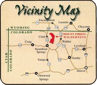 |
Overview:The Mount Zirkel Wilderness is located in North Central Colorado near the towns of Walden, Steamboat Springs, and Clark Colorado, just south of the Wyoming border. The wilderness lies within the Routt National Forest on 160,648 acres of land which straddle the Continental Divide and includes the Park Range and the southern edge of the Sierra Madre Range. The rugged peaks of the Sawtooth Range and the headwaters of the Elk, Encampment, and North Platte Rivers also lie within the wilderness. The highest point is the wilderness is the peak of Mount Zirkel at 12,180 feet, one of 15 peaks in the wilderness over 12,000 feet elevation. The wilderness contains over 70 lakes. |
||||||||||||||||||||||||||||||||
History:The first organized US expedition into North Central Colorado was led by John Charles Fremont in 1844. At that time North Park was considered territory of the Ute tribe, who would repel occasional incursions by Arapaho and Cheyenne hunting parties. North Park contained immense buffalo, elk, antlope and deer herds before US settlement. When Fremont passed through the park, he found a broad muddy trace left by buffalo herds who traveled over the low pass between North and South Parks which is known today as Muddy Pass. Likewise, a well worn path over the Park Range was used by buffalo herds migrating from North Park to the Yampa River valley. This path was made into a wagon road over the pass that retains the name Buffalo Pass at the southern edge of the wilderness. A reconnaissance geologic exploration of the Colorado Territory was completed in the late nineteenth century. This included petrographic studies of crystalline rocks found at Mount Zirkel by Ferdinand Zirkel, for whom the mountain is named. On June 12, 1905 the Park Range Forest Reserve was created on lands that included the Mount Zirkel Wilderness. In 1908, the forest reserve was renamed the Routt National Forest in honor of former Colorado governor John Routt. In 1964 the United States government did something truly unique. With the passing of the 1964 Wilderness Act, our government created the National Wilderness Preservation System. This act acknowledges the value and importance of retaining land in a wilderness state for the enjoyment of everyone. With the passing of the Wilderness Act in 1964, the Mount Zirkel Wilderness was created on 72,180 acres surrounding the peak. In 1980, the Mount Zirkel Wilderness was enlarged to 139,898 acres. Finally the Colorado Wilderness Bill of 1993 added 20,752 acres to the wilderness at the north end of the wilderness. This final addition includes vital lower elevation habitat which is underrepresented in the Wilderness Preservation System. The Mount Zirkel Wilderness today:The present day Mount Zirkel Wilderness contains about 170 miles of trails. These trails travel through lands ranging from 7,400 feet elevation along Mad Creek on the west side of the divide to a maximum of 12,180 feet atop Mount Zirkel. A variety of ecosystems may be found within the wilderness, mostly depending on the elevation of the area. At low elevations, forests of Lodgepole Pine can be found along with aspen groves and sagebrush meadows. As the trails ascend the mountains, forests of Englemann Spruce and Subalpine Fir dominate above 9,000 feet elevation. These mountain forests may contain scattered subalpine meadows or parks. Treeline in the area is at about 10,400 feet, and above this elevation alpine tundra dominates. |
|||||||||||||||||||||||||||||||||