|
|
|
|
|
|
 |
|
|
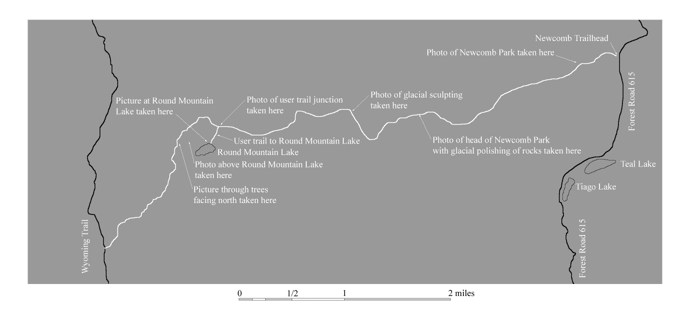
Newcomb Creek Valley
|
|
This shows the Newcomb Creek Valley facing east not far from the trailhead.
|
|
|
|
|
|
|
 |
|
|
Round Mountain at head of Newcomb Creek Valley
|
|
This shows the head of the valley where the trail begins to climb toward the Continental Divide. Glacial sculpting and polishing of the bedrock to the right of Round Mountain is evident.
|
|
|
|
|
|
|
 |
|
|
Glacial Sculpting near the trail
|
|
This shows the beautifully sculpted rock found along the trail as it climbs out of the Newcomb Creek Valley. Large rounded boulders that were deposited by the glacier are also found along the trail.
|
|
|
|
|
|
|
|
|
|
 |
|
|
Trail junction with user trail to Round Mountain Lake
|
|
This picture shows the trail junction with the user trail leading to Round Mountain Lake. The trail junction is in a heavily forested area.
|
|
|
|
|
|
|
 |
|
|
Round Mountain Lake
|
|
This picture was taken along the bank of the lake facing west.
|
|
|
|
|
|
|
 |
|
|
Round Mountain Lake
|
|
This picture was taken near the trail above the lake and facing east.
|
|
|
|
|
|
|
|
|
|
 |
|
|
Along the climb to the Divide
|
|
This picture was taken along the trail facing north along the way to the Continental Divide.
|
|
|
|
|
|
|
|
|
|