|
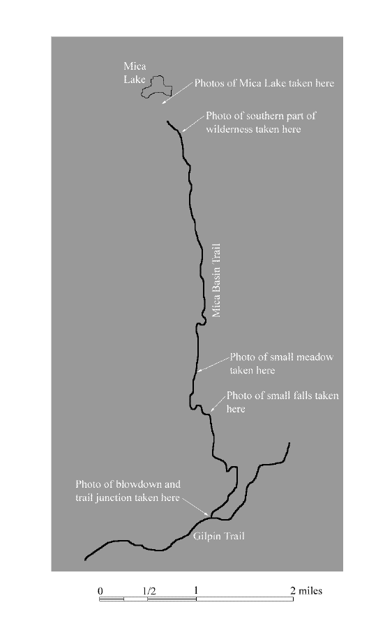
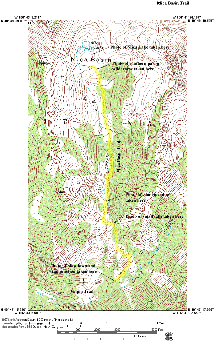
The map above is provided to minimize download time. To see the full topographical version of the map, click on the thumbnail below.
Click on the thumbnails below to view full size photographs.
|
|
|
|
|
|
 |
|
|
Mica Basin and Gilpin Trails junction
|
|
This shows the trail juction with Gilpin Trial. Notice the extensive blown down trees in the area caused by the Routte Divide Blowdown. All the trails have been cleared.
|
|
|
|
|
|
|
 |
|
|
Mica Creek
|
|
This shows a water fall near the trail.
|
|
|
|
|
|
|
 |
|
|
Meadow
|
|
This shows a typical small meadow encountered on the way to Mica Lake.
|
|
|
|
|
|
|
|
|
|
 |
|
|
View of southern wilderness
|
|
This shows The Dome and Lost Ranger Peak which are in the southern portion of the Mount Zirkel Wilderness.
|
|
|
|
|
|
|
 |
|
|
Mica Lake
|
|
This shows Mica Lake with Little Agnes Peak in the background.
|
|
|
|
|
|
|
 |
|
|
Mica Lake
|
|
This shows Mica Lake with Big Agnes Peak in the background.
|
|
|
|
|
|
|
|
|